“The goal of Tysons Wastewater Conveyance Systems Modifications project is to increase the size of the sewer system to accommodate the planned growth in the northern Fairfax County."
Most recent changes will appear at the top of this page, with progressively older information below.
Media
The project has been featured in these FFX Now articles:
- Feb 20 2025 Fairfax County seeks land rights for new Tysons West sewer line
- Nov 18 2024 Ground breaking for wastewater pump station.
- Oct 15 2024 County plan to take McLean house for wastewater station surprises residents (pertains to Tyson’s East - “not listed on the DPWES website or in the county’s capital improvement program” - not West)
- Oct 31 2023 Planning commission approval of a wastewater pump station.
- May 9 2022 Initial project background.
Design Document
Following a Virginia Freedom Of Information Act request the document below, created August 16, 2024, was made available on January 28, 2025.
Force Main Submittal DrawingsBefore downloading it please note that this is over 120 pages and 100 MB of detailed maps and engineering drawings that cover areas from Flint Hill Road to Leesburg Pike.
To orient yourself G-1 (page 2) lists street intersections and control point station numbers for the different plan types; while the key map on page G-5 shows the areas the detailed Civil pages span. TCA people will be most interested in C-3 (page 9) to C-10 (page 16), and Sta 20 to Sta 65. For example: Page C-8 (page 14) covers the area between the intersection of Rhapsody Drive and Concert Court and past the corner of Abbotsford and Rhapsody Drives, beginning near Station 45. Each Civil sheet also has notes identifying the corresponding Erosion and sediment control plan, Tree preservation and planting plan, and Phasing notes sheets as well as other pertinent notes.
Tree Preservation general details start on TP-1 (page 70) followed by a key map of the areas the detailed plans span. TCA is covered by TP-7 (page 76) to TP-12 (page 82.)
Community Meetings
On Dec 9 the county emailed about upcoming community meetings to discuss the project that will be directly impacting TCA.
Tanglewood/Southwestern: Rescheduled to Wednesday, Jan. 22 | 6 p.m. – 8 p.m. | Madison High School
DPWES staff will be in attendance to talk more about the project and answer your questions.
Below is information gathered at that meeting which a number of TCA members attended. More will be forthcoming when provided by the county.
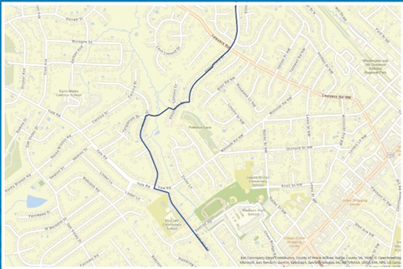
Map of the segment directly impacting TCA
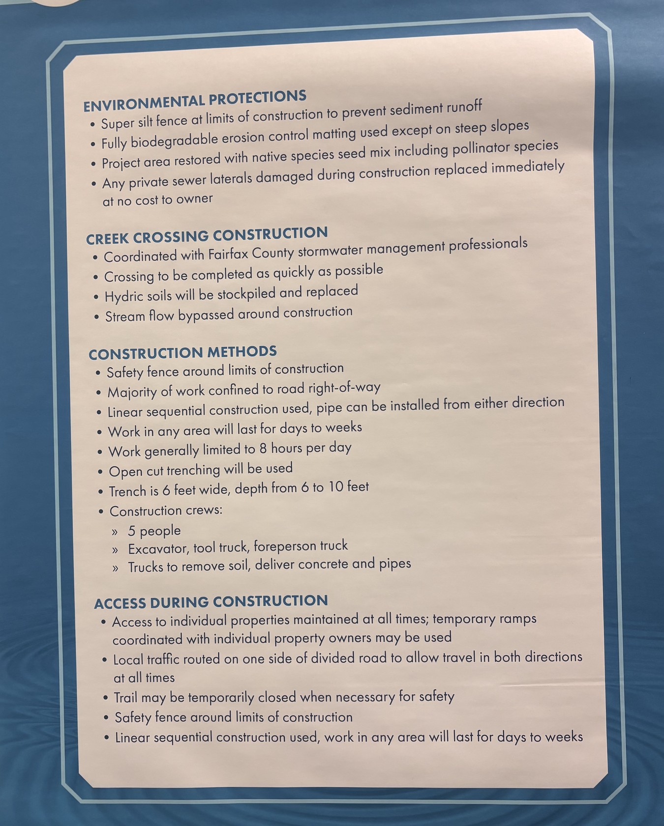
Poster of project goals
In the images below circles locate trees identified as being impacted by the project. (Some neighborhood walkers have noted the numbered metal tags that have appeared on trees in the last year.) Empty circles denote “protected” trees. Circles with Xs denote trees that will be removed during project construction.
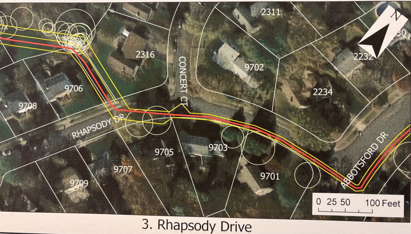
Alignment of work along Rhapsody Drive
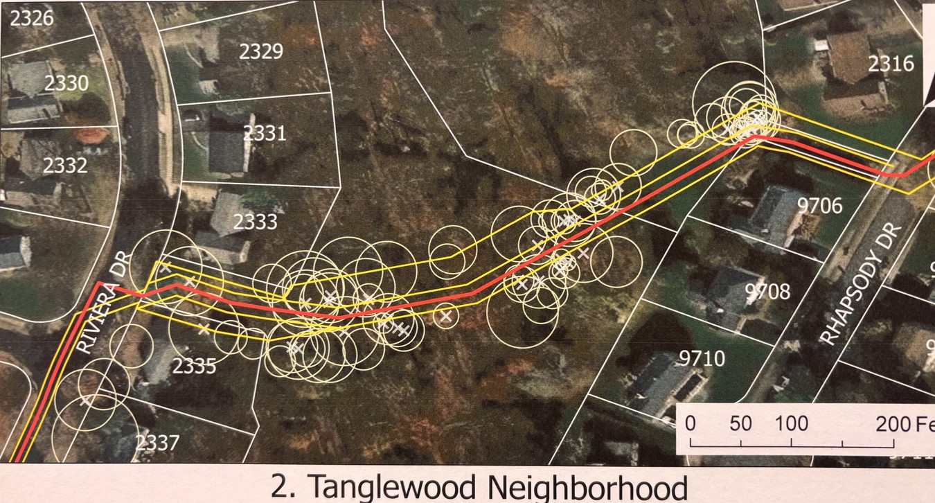
Alignment and tree impact in park and adjacent areas
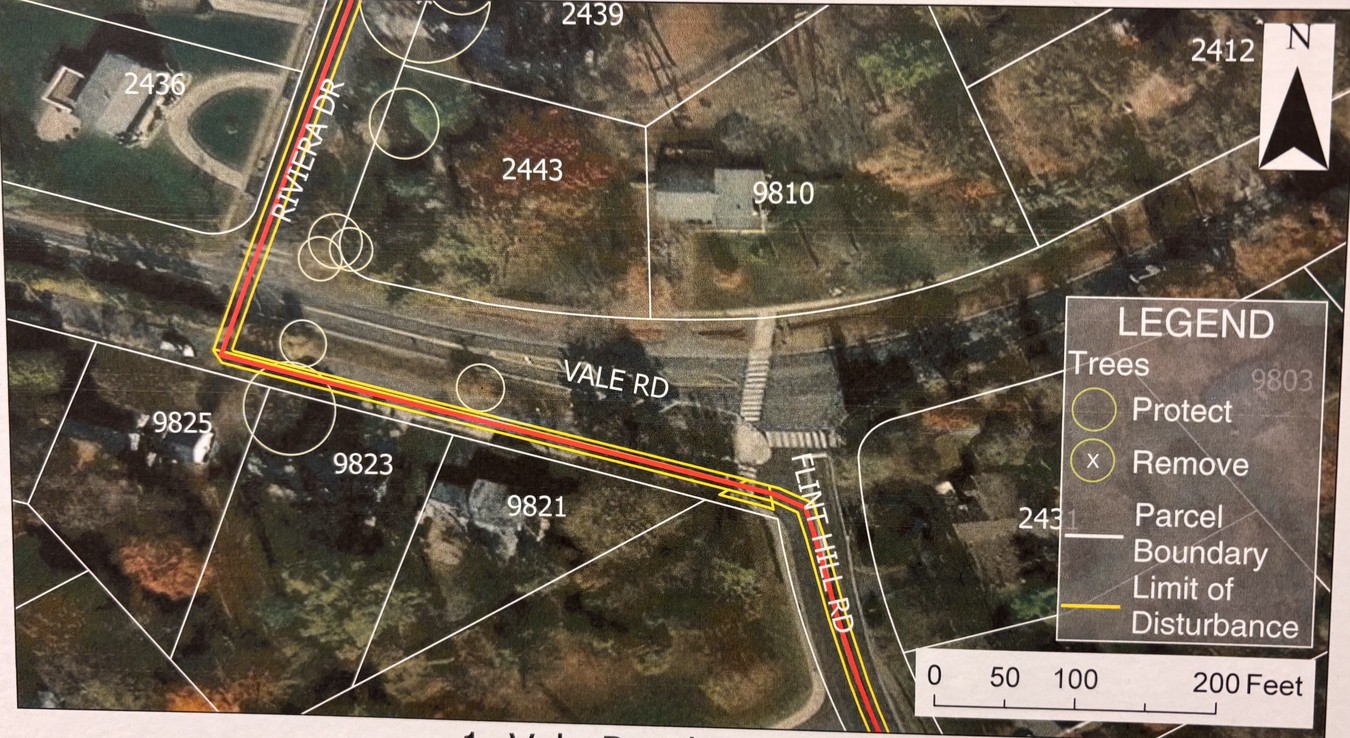
Alignment crossing Vale Road
The image below depicts a vertical view of the elevation of the sewer and the ground surface along the path indicate by the red line along Abbotsford and Rhapsody Drive, through the park, and along Riviera Drive crossing Vale Road.
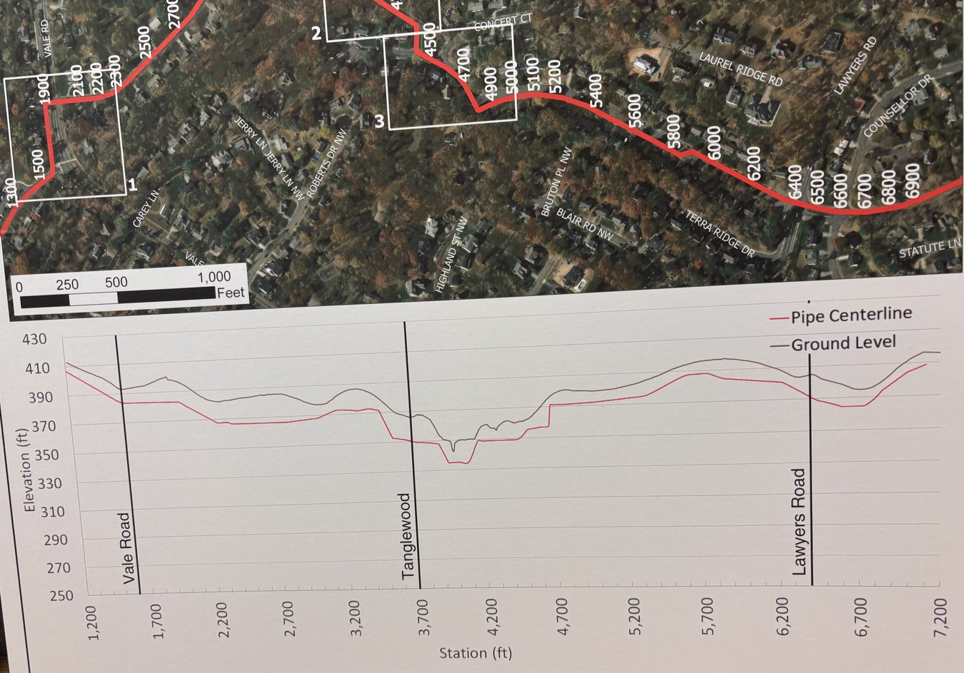
Cross section of ground surface and sewer
Construction Schedule for TCA Area
The current (estimated) work schedule is shown below.
| Pipe Station | Location | Estimated Start | Estimated End |
|---|---|---|---|
| 64+00 to 48+03 (1597 feet) | Abbotsford Dr. West of Lawyers Road | June 1, 2027 | August 30, 2027 |
| 48+03 to 44+00 (403 feet) | Rhapsody Drive | Aug 31, 2027 | Sept 21, 2027 |
| 0+00 to 1+25 (125 feet) | Rhapsody Drive 8"-PVC and new MHs | Sept 22, 2027 | Oct 11, 2027 |
| 44+00 to 37+68 (632 feet) | Between houses and between Rhapsody and Rivera Drive | Oct 12, 2027 | Dec 10, 2027 |
| 37+68 to 20+00 (1,768 feet) | Riviera Drive | Dec 13, 2027 | Apr 4, 2028 |
| 20+00 TO 16+01 (399 feet) | Vale Road | Apr 5, 2028 | May 4, 2028 |
| 16+01 to 00+00 (1,601 feet) | Flint Hill Road | May 5, 2028 | Aug 3, 2028 |
- Working hours generally Monday to Friday, 7:00 am to 5:00 pm
- Work in Virginia Department of Transportation right-of-way will have to comply with hours of operation requirements in VDOT permit issued to Fairfax County
- More information on the construction schedule will be available after the construction project is awarded
South side of W&OD to Lawyers Road (Eudora and Lawyers North Areas)
Note that some work precedes that in the TCA area and some follows.
| Pipe Station | Location | Estimated Start | Estimated End |
|---|---|---|---|
| 129+00 to 111+18 (1,782 feet) | Abbotsford Drive west of Beulah Rd | Apr 14, 2028 | Aug 01, 2028 |
| 111+18 to 88+54 (2,264 feet) | Eudora Park/Stream Crossings/ W&OD Crossing | June 02, 2026 | Dec 24, 2026 |
| 88+54 to 64+00 (2,454 feet) | Abbotsford Drive east of Lawyers Rd | Dec 25, 2026 | May 31, 2027 |
Background Information
The project’s Preliminary Engineering Report, from March 2021, and revised in February 2022, was made available as an update on Fairfax County’s web site in August 2022.
While the project estimates “that construction impacts will last for only a few days in one location along the pipeline” the currently favored plan has work proceeding through much of TCA. Members can expect disruptions for an extended period.
Section 5.2.6 Route Alternative 6 of the Preliminary Engineering Report describes the planned path: The force main will continue 4,000 lf down Abbotsford Drive until veering right onto Rhapsody Drive. The force main will continue 400 lf down Rhapsody Drive before turning right onto a walking trail. It then will travel 900 lf on the walking trail through the park toward Riviera Drive. The force main then will travel south for 1,800 lf down Rivera Drive. It then will turn left onto Route 672 for 350 lf and then turn right, heading south down Flint Hill Road.
An excerpt from Figure 5-32 below, shows the project path on aerial imagery.
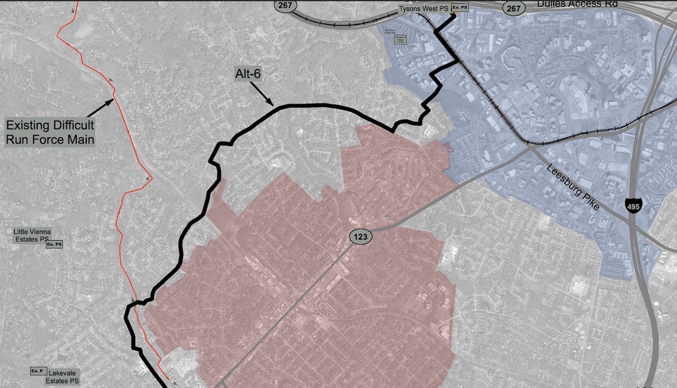
Tysons West PS Force Main Alternative - 6 through TCA
The map below shows the selected project path through TCA in more detail.
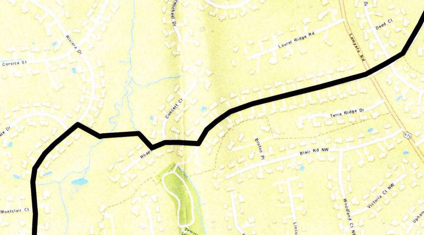
Currently selected project path
The project’s initial design for force main alignment through Tanglewood Park that preceded test borings in October 2023.
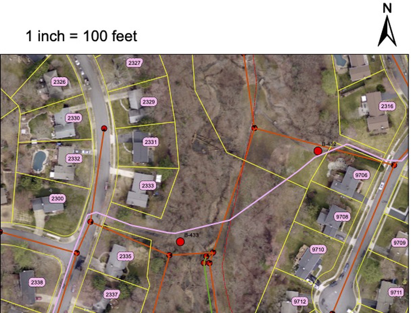
Sewer alignment and test boring locations
See Fairfax County’s Tysons West Wastewater System Enhancements page for background, location details, and timeline information. The slides and a recording from the May 10 meeting are currently available.